ATV TrailsSiteLock
Books Maps & Guides

Home

Map Store

Trails

Contact Me

770-463-2346

8am-4:30pm EST Monday through Friday

All Items are shipped next business day via USPS Priority Mail
You will be provided tracking info via email

ATV Trails Guide Moab, UT
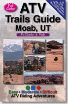
National Geographic Maps 500 + 501

Atv Trails Guide Moab, UT This new full-color guide has been designed specifically for ATVs, but trails are also great for dirt bikes. Precise directions, pinpoint maps and stunning color photos guide you through Moab, Utah’s legendary backcountry. Thirty “cruiser-to-bruiser” routes provide thrilling rides for all skill levels. Learn where to unload and places to camp. Stay on course with handy GPS waypoints. New easy-to-use ATV format.

  This combo deal also includes National Geographic's Trails Illustrated Maps 500 + 501 which show the entire area around Moab

Add To Cart

$38.85
You Save $4

Complete Trail Listing

1. Crystal Geyser (E)
2. White Wash Sand Dunes (M)
3. Tenmile Wash (M)
4. Rainbow Terrace (M)
5. Dellenbaugh Tunnel,Secret Spire (M)
6. Hey Joe Canyon (D)
7. Determination Towers (M)
8. Sevenmile Rim (D)
9. Sovereign Trail (M)
10. Gemini Bridges (E)
11. Bull Canyon (E)
12. Poison Spider Mesa (D)
13. Potash Road (E)
14. Hurrah Pass (E)
15. Chicken Corners (E)

 
16. Kane Creek Canyon (D)
17. Picture Frame Arch (E)
18. Kane Creek Canyon Rim (D)
19. Dome Plateau (M)
20. Pole Canyon Rim (E)
21. Top of the World (D)
22. Dolores River Overlook (E)
23. Onion Creek (E)
24. Fins & Things (D)
25. Steelbender Loop (D)
26. La Sal Pass (M)
27. Hideout Mesa (M)
28. Greasewood Canyon (D)
29. Cameo Cliffs/Wilsons Arch (M)
30. Cameo Cliffs/El Diablo (D)

Moab ATV Trails

    Add To Cart
 

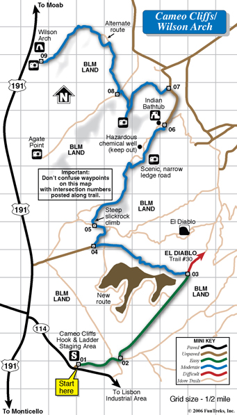
Detail of Typical Trail Map
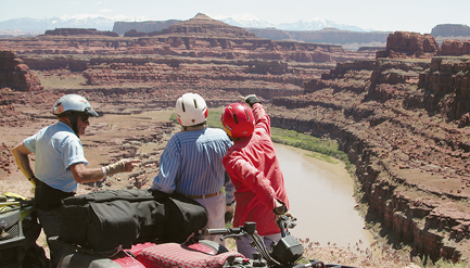
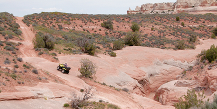
Moab Maps


    Add To Cart
 

Sample Photos

Potash Road Trail

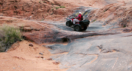
Potash Road, Trail #13, Easy

Dome Plateau Trail

Dome Plateau, Trail #19, Moderate

Poison Spider Mesa

Poison Spider Mesa, Trail #12, Difficult

 
    Add To Cart
 

Sample Pages

Maob Trails

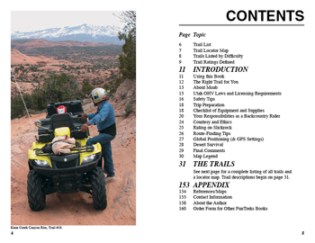
Pages 4 & 5, Contents.

Utah Guide Book

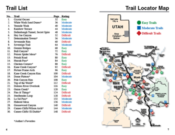
Pages 6 & 7, Trail List and Locator Map.

dirt bike trail guide

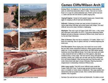
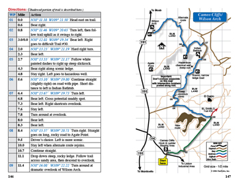
Pages 144 & 145, first two pages of trail description.

dirt bike maps utah

Pages 146 & 147, second two pages of trail description

 
  Add To Cart  
 

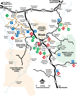
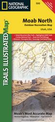
500 Moab North

This Trails Illustrated topographic map is the most comprehensive and complete recreational map for the areas south of Moab, Utah. The map shows all trails, campsites, and recreational features, plus ratings and mileage for mountain biking trails and junction-to-junction road and trail mileage.

Coverage area includes Green River, Fisher Towers and Arches National Park; highlighted Jeep Safari Trails and Mountain Bike Trails from Moab to Interstate 70; enhanced coverage of Dubinsky Wash to the Green River. Includes detailed 1:35,000 scale insets of Moab, Slickrock Bike Trail, Sand Flats Recreation Area, and Monitor and Merrimac Buttes/Bartlett Wash Area.

All data is updated to reflect road closings, new trails, and campground relocation. Printed on waterproof, tear-resistant material with a plastic coating that offers supreme durability for your next outdoor adventure.

Scale = 1:70,000.


501 Moab South

Coverage area includes Moab, Dead Horse Point State Park, Behind the Rocks WSA, Hurrah Pass and Canyonland's White Rim; highlighted Jeep Safari Trails from Moab to Canyon Rims Recreation Area; and detailed 1:35,000 scale insets of Moab, Moab Rim, Poison Spider Mesa, Gold Bar Rim, and Gemini Bridges Area.

All data is updated to reflect road closings, new trails, and campground relocation. Printed on waterproof, tear-resistant material with a plastic coating that offers supreme durability for your next outdoor adventure.

Scale = 1:70,000